Yesterday’s Activities: The continuation of cooler, wetter weather allowed crews to take advantage of opportunities to build line closer to the fires edge where it was safe and effective to do so. Cooler temperatures across the fires, combined with relative humidity values of 40-50 percent subdued fire behavior. Fire continues to smolder and creep in forest debris such as needles, small twigs and branches. The fire was more active on the southwest edge and spread was kept in check by air support. Burnouts were performed on Rattlesnake gulch area as well as from Highway 155 to the north. Some evacuation levels were lowered to allow bus routes to operate for the beginning of school.
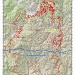
Today’s Operations: The objectives for these fires continues to be, in order of importance, protection of life, protection of property and structures and protection of natural resources. Mitigating the threat to the communities of Republic, Nespelem, Aeneas Valley, Crawfish and scattered residences throughout the fire area is the primary mission once risks to life and safety have been addressed.
On the North Star Fire, crews will continue to build on progress made yesterday. Firefighters will be looking for and taking advantage of opportunities to build line directly adjacent to the fire’s edge and to burn out between the fireline and the edge of the fire south of the Republic, in the Aeneas Valley area.
Firefighters will be working to finish the contingency line between the North Star and Tunk Block fires on the north side.
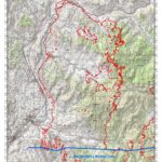
On the Tunk Block Fire, crews will continue work securing homes in the Crawfish area. Dozers will be building line in the northeast portion of the fire.
Weather: The forecast is for cool, breezy conditions with a 20 percent chance of rain showers. High temperatures will be in the 65-75 range. Relative humidity levels will be between 35-45 percent gusty winds up to 25 MPH.
Evacuations/Closure Information: Evacuation and closure information is dynamic and changes more frequently than this report is updated. For the most current evacuation information, please contact your closest Emergency Operations Center (EOC): Colville Tribal Emergency Services 509-634-2105, Okanogan County EOC (509) 422-7206, Ferry County EOC 509-775-3132.
National Forest Lands east of Tonasket and south of Highway 20 on the Tonasket Ranger District are closed. Colville Indian Reservation forest and recreational areas are closed.
Highway closure information is available online: http://www.wsdot.com/traffic/trafficalerts


