Washington operations help maintain lake levels for many uses
YAKIMA – Due to rising temperatures and spring runoff, water levels in Osoyoos Lake are rising. In some years, this can result in temporary flooding on properties around the lake.
The lake straddling the British Columbia and Washington border near Oroville, serves as a source of water for irrigation and summer recreation in both the U.S. and Canada.
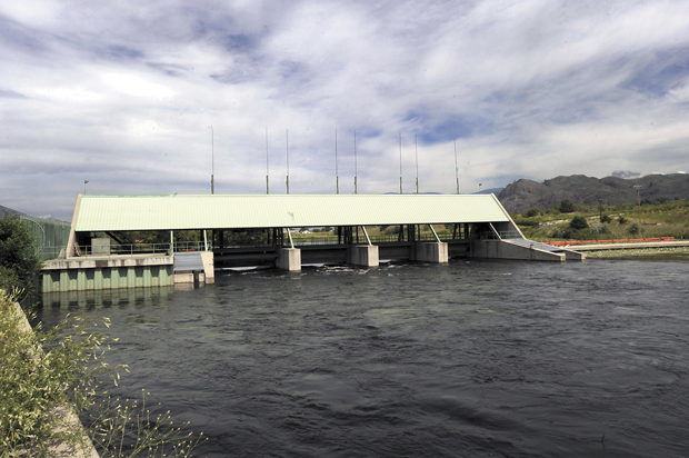
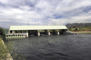
The Washington Department of Ecology regulates lake levels at Zosel Dam in Oroville. Lake levels can fluctuate into early July depending on snowpack, explained Al Josephy, an environmental planner with Ecology. Ecology seeks to maintain the water level between 911.5 and 912 feet from May 1 to Sept. 15, but occasionally there’s a chance for flooding when snowmelt and runoff are high.
“We have the gates of the dam wide open right now, trying to keep the lake at our target level,” Josephy said.
Sometimes the lake rises beyond 913 feet and rarely reaches as high as 915 feet, causing temporary flooding.
Lake Osoyoos is fed from Okanagan Lake in Canada. Making room for snow runoff in the upper watershed puts pressure on smaller Lake Osoyoos. Water also backs up below the dam when the much larger Similkameen River joins the Okanogan River below Oroville during spring snowmelt, Josephy said. This makes managing spring runoff difficult throughout the system.
Lake levels are mandated by the International Joint Commission (IJC), a board made up of representatives from the United States and Canada. For more information on the operation of Zosel Dam or Lake Osoyoos, contact Al Josephy at Ecology at 360-407-6456. Additional information on the International Osoyoos Lake Board of Control and the new Order of Approval can be found at http://ijc.org/boards/iolbc/.
To track the progress of lake levels in “real-time,” as well as find additional information, go to the U.S. Geological Survey web page for Osoyoos Lake.
Washington operations help maintain lake levels for many uses
